Aerial imagery of flooded areas is key to determining the extent of damage and changes in the land surface

Aerial footage of flood-affected areas we captured 7. and 8 August 2023 are key to determining the damage caused and the extent of changes in landscape.
Aerial Laser and Photogrammetric Scanning for Flood Damage Assessment
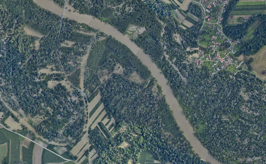
Starting on Monday, August 7th, we commenced aerial scanning of the flooded areas along the Mura River and in the Poljanska Valley (central Slovenia). Additionally, on Tuesday, August 8th, 2023, we captured imagery of the Savinja, Mislinja, and Meža areas. This collective effort spans an impressive 1,700 km2. In order to ensure broad usability of the acquired data, we are collaborating with a diverse set of stakeholders including planners, municipalities, and the Water Directorate, with the goal of defining common objectives and optimizing the timing of aerial scanning.
Flycom Technologies, Irnas, and C-Astral Secure Funding for Pilot-Demonstration Project
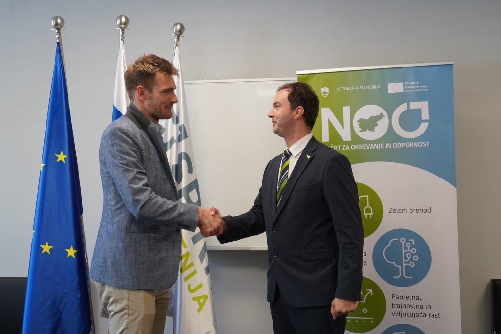
SPIRIT Slovenia, the public agency, received a total of 60 consortium applications in response to the call, but only approved funding for 21 projects. Among them is our project, LIFT Forest – eVTOL AI, aimed at forest biomass analysis.
LIFT Sentinel – LIFT Sentinel AI Terrain Detector

In the framework of the AI4Copernicus open call, we have secured funding for the development of a micro-project, LIFT Sentinel – LIFT Sentinel AI Terrain Detector.
Integration of 3D city models and BIM: GeoBIM

As part of the MSGeo Working Group training, of which we are a part, we attended a two-week workshop on the integration of BIM and GIS organised by EuroSDR.
Flycom Technologies part of development consortium with a project linking smart cities for more sustainable development

The development-oriented consortium, of which Flycom Technoloiges is a part, in addition to the telecommunications operator T2 and Solviks, is co-creating a more sustainable development of the economy and society through the project “T-2 Smart Cities 4.0”, so that they are better prepared and more resilient to the challenges and opportunities of the green and digital transition.
Spatial data acquisition and production of GIS overlays of road infrastructure in the municipality of Ajdovščina

In the Municipality of Ajdoviščina, we expect to complete spherical photography and mobile laser scanning of municipal roads by the end of this year.
T-2 Smart Cities 4.0″ project receives EU co-funding

Flycom Technologies d. o. o. as a consortium partner, has received co-financing from the European Union’s Recovery and Resilience Fund to implement the activities of the T-2 Smart Cities 4.0 project.
Laser airborne surveys of the Austrian Länder of Carinthia and Styria
The project is a two-year project and, in addition to the laser scanning of a total area of about 7000 km2, a key part of the project is the classification of the point cloud and the implementation of a digital elevation model of part of the lands in the south of Austria.
Mobile laser scanning of Ljubljana’s road network
In the City of Ljubljana, municipal roads will be recorded by May 15 with mobile laser scanning (MLS) and spherical photography (SF).
Thermographic inspections of transmission lines to reduce power losses
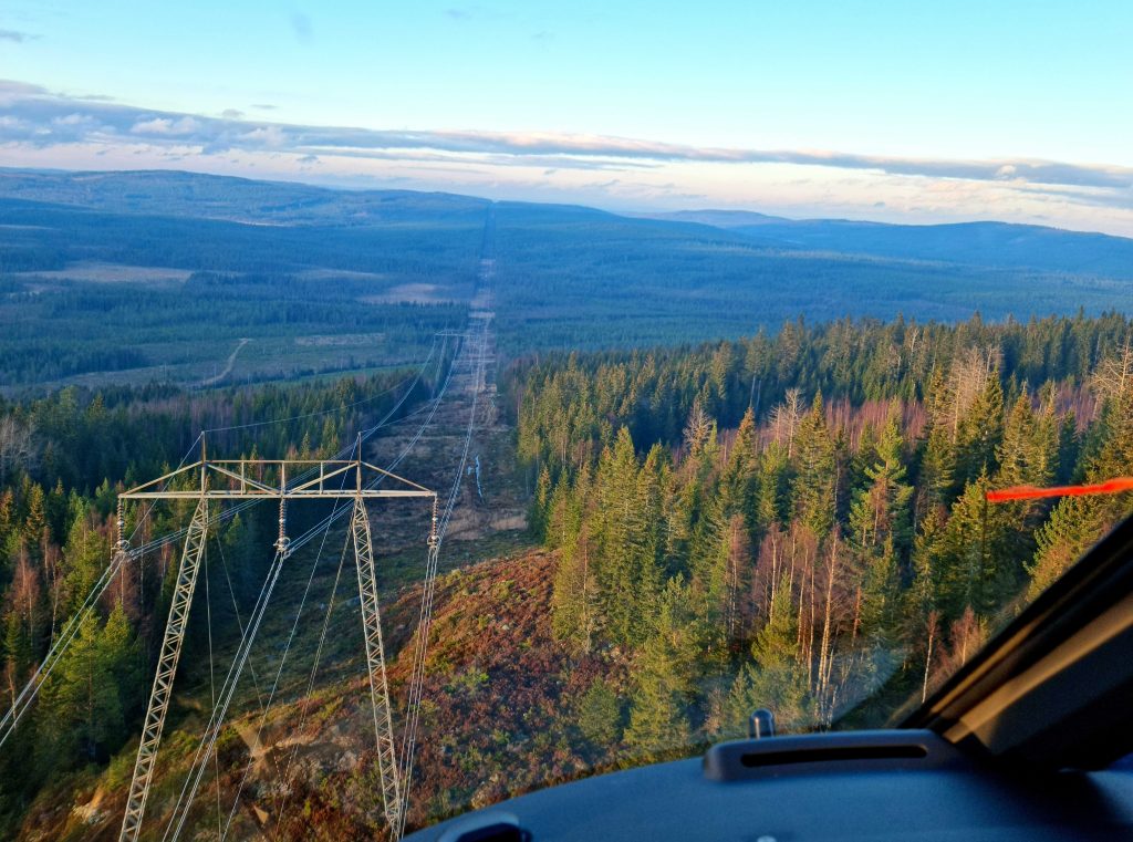
At Flycom Technologies, we use the latest technology in thermography to quickly and efficiently diagnose and interpret faults in power supply equipment.
Multisensor aerial survey of the Republic of Croatia
Flycom Technologies is part of an international consortium that signed a contract with the State Geodetic Administration of the Republic of Croatia at the end of 2021 for the project “Multisensor Aerial Survey of the Republic of Croatia for Natural Disaster Risk Assessment”