Aerial laser and photogrammetric data of the flood-affected areas taken on 7. and 8 August 2023, are crucial in determining the damage caused and the extent of changes in landforms.
Flycom Technologies acquired RGB and NIR camera overflights of all major watercourses and flooded areas at a resolution of 8-10 cm, as well as laser data at a density of 15-20 pixels/m2. In the meantime, we have produced some final products to be used as quickly and widely as possible.
Comparisons of changes on the terrain based on orthophotos (e.g. Cyclic Aerial Photography of Slovenia) and with post-flood RGB imagery captured at 10 cm resolution.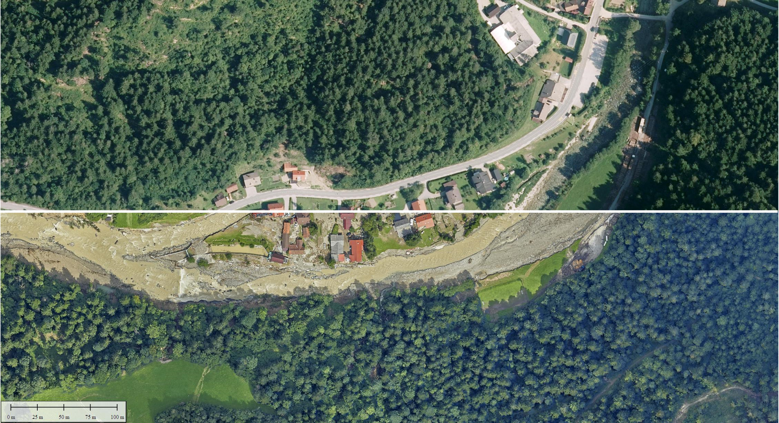
The recording was performed in four channels (R, G, B and NIR), from which we created RGB and/or CIR (color infrared) orthophotos with a resolution of 10 cm.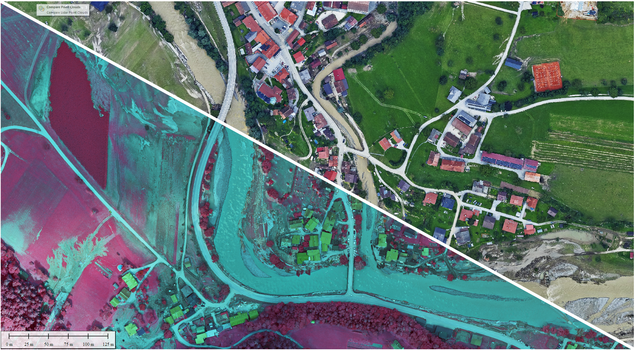
A digital elevation model and/or a digital surface model were produced from the 10-12 point/m2 aerial laser data captured in the flooded areas.

3D model of the flooded area.

The data we have captured will be key in assessing the extent of damage following this elemental event. Access to the basic set of products (RGB and CIR orthophoto mosaics, etc.) will be provided by the Water Directorate of the Republic of Slovenia through its own infrastructure. Slovenia through its own infrastructure.
Other products are available to potentially interested customers via direct enquiry at info@flycom.si.