Spatial
software solutions
LIFT: Local Intelligence by Flycom Technologies
- Advanced proprietary geographic information system (GIS).
- It combines geospatial and business intelligence.
- Enables advanced spatial queries.
- It offers a quick, easy and fully customisable display.
- Full flexibility depending on the user’s domain.
- Compatible with other systems such as CAD, ERP and BI.
Users and subscribers:
Public sector
Municipalities and ministries
Geodetic Administration (GURS)
Faculties, institutes and public institutions
European Space Agency (ESA)
Infrastructure sector
Energy sector (ELES, Petrol)
Telecommunication companies
Utilities
Private sector
Surveying companies
Logistics and transport sector
(DARS, Slovenian Railways)
Banks and insurance companies
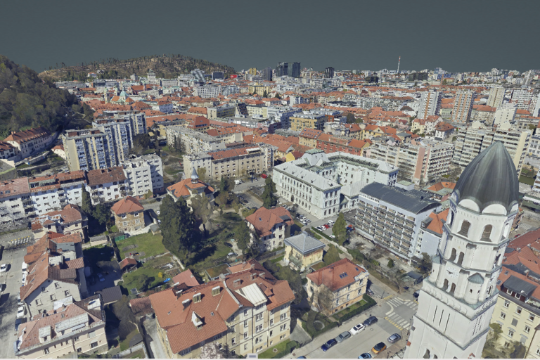
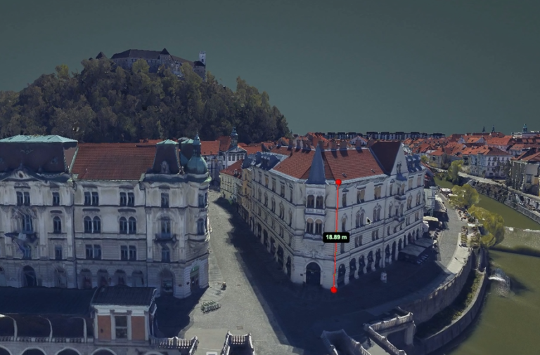
What does the LIFT Viewer do?
Personalised data display
2D, 3D and 360° views and point cloud display
Advanced analysis
Weather analysis, element detection, road route calculation, tracking changes in space
Simulations
Simulations of floods, noise, visibility, traffic, and the impact of climate change
Additional features
Precise measurements, infrastructure display, data integration, dashboard creation
What does the LIFT Viewer do?
Personalised data display
2D, 3D and 360° views and point cloud display
Advanced analysis
Weather analysis (rainfall, hail, wind, temperature), calculation of road routes.

Simulations
Simulations of flooding, noise, visibility, traffic and climate change

Additional features
Precise measurements, infrastructure display and overview of cyclical changes
products
LIFT Smart City
Innovative solutions for smart cities
LIFT Roads
Optimise the view and display of data
LIFT Live
Advanced real-time data management
LIFT Mobile
Optimised module for mobile devices
LIFT Insurance
Advanced solutions for insurance companies
LIFT AutoCAD
Seamless integration with AutoCAD Map 3D
LIFT Fibre
A key geolocation tool for network operators
LIFT UAV
Advanced module for accurate data collection and analysis
LIFT Green
Platforms for accelerating the green transition to solar energy.