Event: “Digital Twin of Slovenia – First Insight”
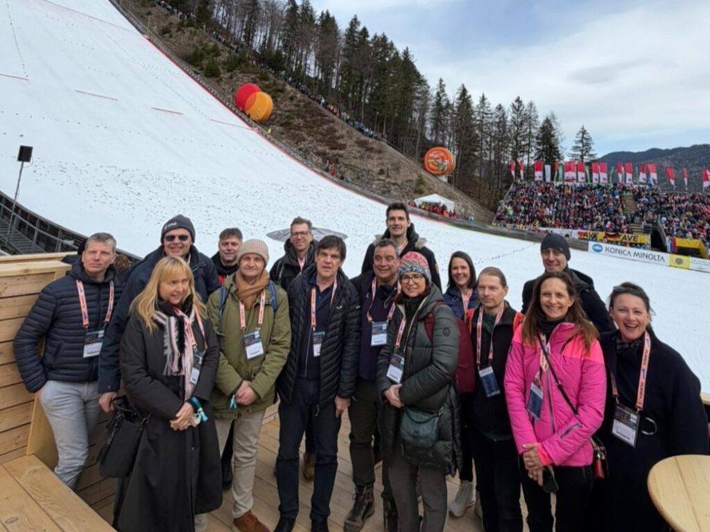
As part of the ESA project, we co-organized and led the event “Digital Twin of Slovenia – First Insight“. The meeting on March 29, 2026, in Planica, was dedicated to the first insight into the project results, the importance of the Digital Twin of Slovenia at national and operational levels, support for preparedness, response, and […]
Cyclical Laser Scanning of Slovenia (CLSS)
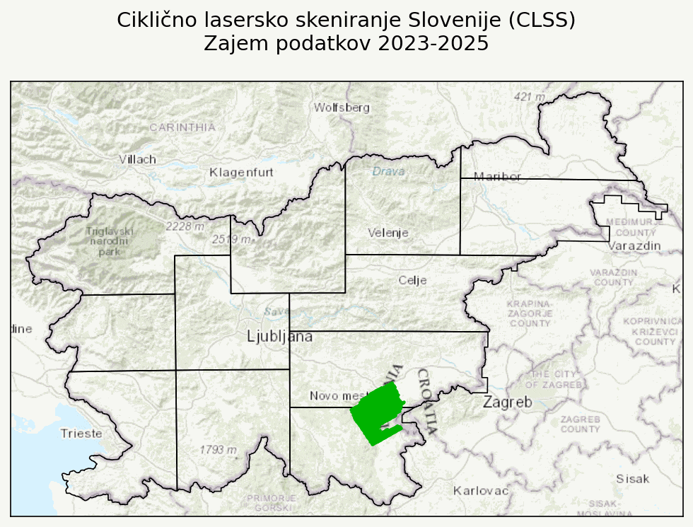
Between 2023 and 2025, Flycom Technologies collected data as part of the “Cyclical Laser Scanning of Slovenia (CLSS)” project. Aerial acquisition of LiDAR data and RGB+NIR imagery was carried out in three phases: The animation shows the timeline of data acquisition, while the second image shows the complexity of the acquisition, where each colour represents […]
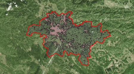
Ajdovščina Case Study
Through aerial capture and processing of the town of Ajdovščina, we have created a digital model of the town. This is an advanced smart city project that combines the integration of LiDAR and orthophoto data, the creation of a 3D model, and advanced spatial analysis. The integration of the captured data enables: GIM International magazine […]
Review of the previous year

We enter the new year with excitement about the projects and challenges ahead. But before we fully bid farewell to 2024, we’ve prepared a recap of our key business achievements. Last year, due to the expansion of the company and the increased volume of work, we moved to new premises. We are now located on […]
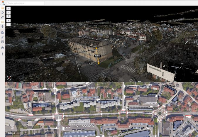
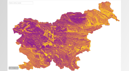
New CLSS portal brings advanced laser scanning data to the palm of your hand

Cyclical laser scanning data is available for viewing and download on the new portal https://clss.si. In addition to viewing and downloading, the portal also allows you to perform simple measurements (points, distances, areas (3D), and angles), view coordinates with the date of capture, and share views. You can learn more in the short presentation video. […]
Successful implementation of the “LIFT Forest – eVTOL AI” project for forest biomass analysis in the framework of the DEMO PILOTI NOO JR
The consortium of partners Flycom Technologies, C-Astral and IRNAS is successfully advancing the project “LIFT Forest – eVTOL AI”, which is being implemented in the framework of the Call for Pilot Demonstration Projects for Recovery and Resilience (NOO). The project combines advanced technologies for forest management and the use of drones equipped with technologies such […]
Have you heard about Flycom’s latest World Bee Day initiative?
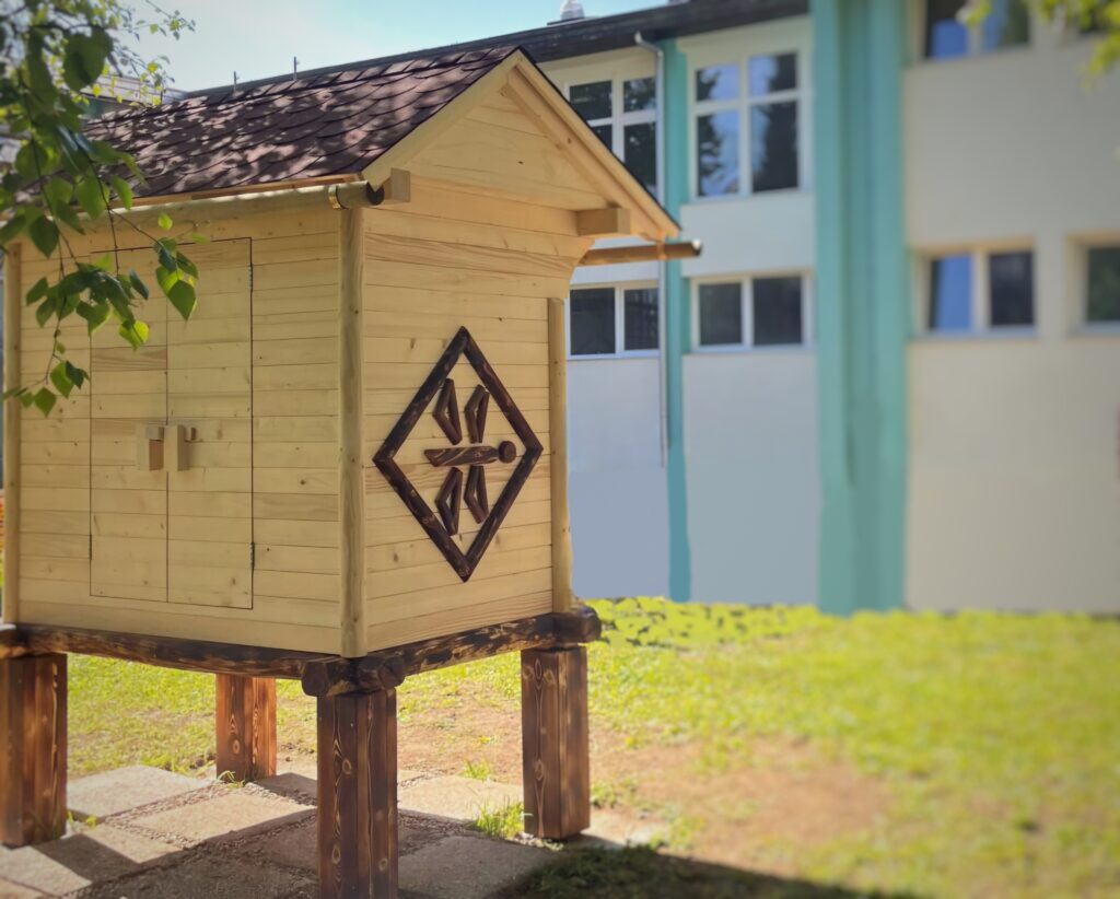
At Flycom Technologies, we are committed to sustainable and responsible business towards society and the environment. This is one of our key values, which we implement through various projects and initiatives. On this year’s World Bee Day, May 20, we decided on a special campaign and gave young beekeepers from the Simon Jenko Elementary School […]
Multisensor recording of Croatia 2020-2023
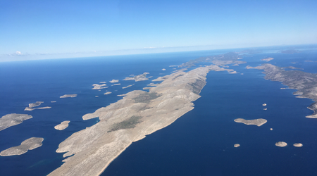
We are proud to announce that Flycom Technologies and its partners have successfully completed LiDAR and photogrammetric survey of the Republic of Croatia – 56,594 km² and corridor LIDAR recording of embankments, with data processing and implementation of the final products. The aim was to provide homogeneous topographic bases from high quality spatial data, which […]
Developing a platform to accelerate the green transition to solar energy LIFT Green
Project background LIFT GREEN Funded by the European Union – NextGenerationEU Participants: The project is implemented within the framework of the call for proposals “Incentives for NOO R&D projects”, which is part of the Recovery and Resilience Plan (RRP) funded by the Recovery and Resilience Facility. A platform that makes information easily accessible Access to […]
AI4Copernicus project – LIFT Sentinel AI Terrain Detector
In the project initiative, out team embarked on a task to enhance the LIFT GIS software’s capabilities through the integration of an advanced automated land classification system. Utilizing the AI4Copernicus service, we developed deep neural network models tailored for build-up, rural, water, and forest land types detection, ensuring minimal user input for maximal output efficiency. […]
About the Pilot-Demonstration Project in Finance

Flycom Technologies in collaboration with consortium partners Irnas and C-Astral, has secured co-financing for the implementation of the pilot-demonstration project, LIFT Forest – eVTOL AI aimed at forest biomass analysis.
Aerial images of flood-affected areas accessible via GeoHub-SI
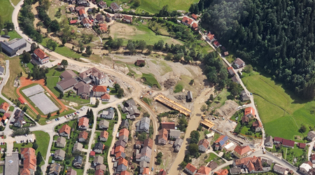
In early August, devastating floods struck Slovenia, significantly altering the landscape of several regions in the country. In an effort to provide transparency and assist in damage assessment, Flycom Technologies conducted aerial laser and photogrammetric surveys of the affected areas.