Through aerial capture and processing of the town of Ajdovščina, we have created a digital model of the town. This is an advanced smart city project that combines the integration of LiDAR and orthophoto data, the creation of a 3D model, and advanced spatial analysis.
The integration of the captured data enables:
- optimized urban planning,
- more efficient infrastructure management,
- dynamic insight into integrated city management.
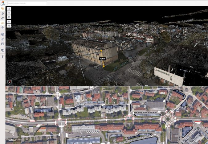
GIM International magazine published an article on the importance and development of digital city models. The article presents successful case studies of combining aerial capture and digital twins, among which our project in Ajdovščina is also mentioned.
More details can be found in the article: “𝐏𝐨𝐰𝐞𝐫𝐢𝐧𝐠 𝐬𝐦𝐚𝐫𝐭 𝐜𝐢𝐭𝐢𝐞𝐬 𝐰𝐢𝐭𝐡 𝐚𝐢𝐫𝐛𝐨𝐫𝐧𝐞 𝐩𝐫𝐞𝐜𝐢𝐬𝐢𝐨𝐧 𝐝𝐚𝐭𝐚“.