All


Flycom Technologies actively participates in national and international industry forums This year are held under the theme of digitisation.
Last week On the 22. and on 23 September, the 50th anniversary Geodesy Day took place in Velenje. The traditional consultation of experts from the broader field of geodesy, geoinfromatics and spatial planning was held this year under the slogan “Digital transformation for sustainable spatial decisions”.
Opening event was held by the Minister of Environment and Spatial Planning, Uroš Brežan, and the President of the Association of Surveyors, mag. Gregor Klemenčič, was attended by over 350 experts, and for the first time this year the participants included senior representatives of state geodetic administrations from the wider region, namely from Croatia, Bosnia and Herzegovina, Serbia, Montenegro, North Macedonia, Kosovo and Bulgaria.
Flycom Technologies was very interested in attending the two-day expert meeting. New technologies for capturing and processing spatial data on the one hand, and high expectations for geodetic and geoinformation solutions in various industries on the other, require us to make continuous progress, which is why we see such events as a great added value in the exchange of experiences, examples of good practice and, last but not least, knowledge.
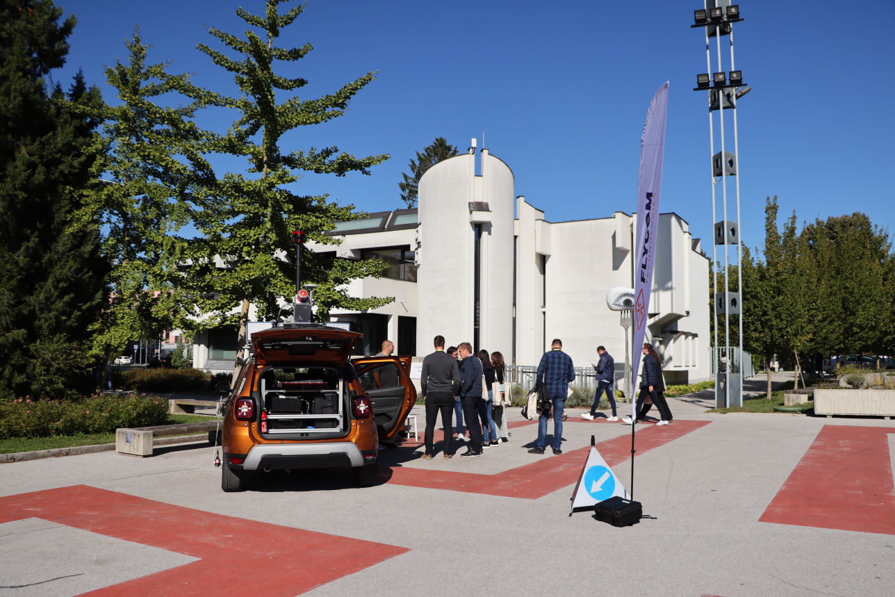
Participation in the event was an additional challenge for Flycom Technologies – we presented the operation of our mobile spatial data capture system, and Katja Šušteršič, project manager in remote sensing, presented the possibilities and advantages of using the fusion of data captured by remote sensing in her lecture.
In October, a team of our employees is also heading to Essen, Germany, for Intergeo 2022, the largest trade fair in the field of geomatics. This year’s event focuses on the digital twins: 3D city models and the use of BIM in surveying and the digitisation of urban planning.
This website uses cookies to enhance your experience. Some are essential for site functionality, while others help us analyze and improve your usage experience. Please review your options and make your choice.
If you are under 16 years old, please ensure that you have received consent from your parent or guardian for any non-essential cookies.
Your privacy is important to us. You can adjust your cookie settings at any time. For more information about how we use data, please read our privacy policy. You may change your preferences at any time by clicking on the settings button below.
Note that if you choose to disable some types of cookies, it may impact your experience of the site and the services we are able to offer.
Some required resources have been blocked, which can affect third-party services and may cause the site to not function properly.
This website uses cookies to enhance your browsing experience and ensure the site functions properly. By continuing to use this site, you acknowledge and accept our use of cookies.